
After our fantastic bikepacking trip through the Monogahela National Forest in 2019, I’ve been jonesing to do more bikepacking trips in West Virginia. Given the remote terrain and former railroads that serviced the coal and timber industries, there are a number of interesting opportunities for off road – but not single track MTB trails (mostly) – bikepacking routes. The longest and perhaps most remote is the North Bend Rail Trail at 72 miles between Clarksburg and Parkersburg. The location of the trail makes it logistically challenging but due to circumstances driven by the aftermath of Hurricane Helene, I finally had a good opportunity to make it happen.
In the middle of the summer, several of my companions from the Erie Canal Trip earlier in the year were planning a set of rides for about a week in southern West Virginia and western Virginia along the Greenbrier Trail and then the New River Trail/Virginia Creeper Trails from Pulaski to Abbington. Since I’ve already ridden the entire Greenbrier Trail, I was not going to participate in that part, but was in for the 3-4 day second part, especially since it would be a camping-based trip. Fast forward to October and hurricane Helene that washed out so much of western North Carolina/Virginia, we had to pivot on the last part because much of the Creeper Trail had significant damage and touring in a disaster area was just not the right thing to do.
This brought in the idea of the North Bend Rail Trail and connecting to that is a set of trails from Morgantown to Clarksburg. I have been eyeing this route for quite some time and my original idea was to start at Deep Creek Lake and ride Morgantown-Clarksburg-Parkersburg-Clarksburg-Morgantown and back to Deep Creek for a total of six days, but even retired, it’s been hard to find the time. In order to keep the overhead low, I typically look for trips that either start and end in the same place, have good transportation options (Amtrak) or some ability to dovetail into a work trip with my wife for a dropoff. As a result, doing just the one way Morgantown to Parkersburg was never really on the table logistically for me to do solo. However, we decided this would be the best pivot and since there were multiple vehicles available, we could do the start/end car shuffle. And since I had to drive out that way anyway, I decided to also join the tail end of the first part on the Greenbrier Trail. While we intended to camp for the Morgantown-Parkersburg three days, we couldn’t find a place to camp anywhere near Clarksburg (with North Bend State Park as the second camp spot) so we also pivoted to “credit card camping” in hotels. That was probably the right move as it was very cold over night and would have meant carrying more gear. I had been worried earlier about the potential for wet and cold conditions this time of year, but as it turns out it was bone dry for several weeks prior to and through out the trip. This was about as nice as it gets for October, cool evenings, and warm sunny days.
I drove out to Watoga State Park which is in the middle of the Greenbrier Trail, then three of us drove two vehicles to Parkersburg to drop one at the western trailhead, then consolidated bikes and drove to Morgantown where we left the other vehicle. At the end, we drove back to Morgantown to retrieve that vehicle and then separately back to Annapolis. Ultimately it was a little more driving that I really care to do for a bike trip (17 hrs/832 miles – basically the same as the drive to Miami!) but over a week’s timeframe it wasn’t bad and highlighted really pretty parts of rural Virginia/West Virginia like the twisty/turny Highland Turnpike (US 250).

Prior to this trip, I had never heard of Watoga State Park, but it’s a fantastic park right off the Greenbrier Trail with multiple campsites and sets of real log cabins built originally by the CCC in the 30s. The park is very well maintained and clearly gets a lot of love from the state. I stayed overnight in my van for two nights and rode one day on the trail and around the park with the other folks who stayed at the cabin. I was really glad I made the tail end of that part of the trip as I met a few people I really should know – the group was really a convention of recovering bike advocates – and it was great to see the park.


Strava Track for the day (56 mies): https://www.strava.com/activities/12617051692
The next part of the trip was a full day of driving to preposition the vehicles, but we eventually got to Morgantown in time for dinner at the Iron Horse Tavern (specializing in Perogies) in town. We had a room at the historic Hotel Morgan across the street. This is a really cool building and well maintained (a Wyndham property), definitely a place to stay if you are in Morgantown. I again stayed in my van as we only had 2 beds in the hotel and that was most comfortable for me. Spending the nights in the van is always my happy place, and that gave others a bed. And in return, I got a bed at both hotel spots along the route. There were still two loose ends of the trip: which hotel in Clarksburg and where to leave the van in Morgantown. Leaving the van for three days in a city was problematic for me: one, because Morgantown proper has many parking restrictions and I can’t get it into a long term garage and two, I hate leaving it out of fear of theft. We researched trail heads and it appeared the best place was the Uffington lot just south of the city. While we were having dinner, the guy next to us struck up a conversation about what we were doing and to make a long story short he gave us the name of the director of the Mon River Trails Conservancy who we emailed and she independently confirmed that parking choice (as an aside for anyone contemplating this route, I stopped at the Marriott next to the trail in downtown Morgantown and they said if you stay there, you can leave a car in their lot for a few days). Additionally, she thought our itinerary was fairly adventurous, I think because they are used to the typical “crushed limestone trail” user (more on this later), and asked if we would provide her some scouting of the North Bend because there was some work recently (I sent her a detail summary). This comment would make much more sense once we got there. We also solved the lodging issue in Clarksburg with a suite at the Townplace Suites just outside Clarksburg.
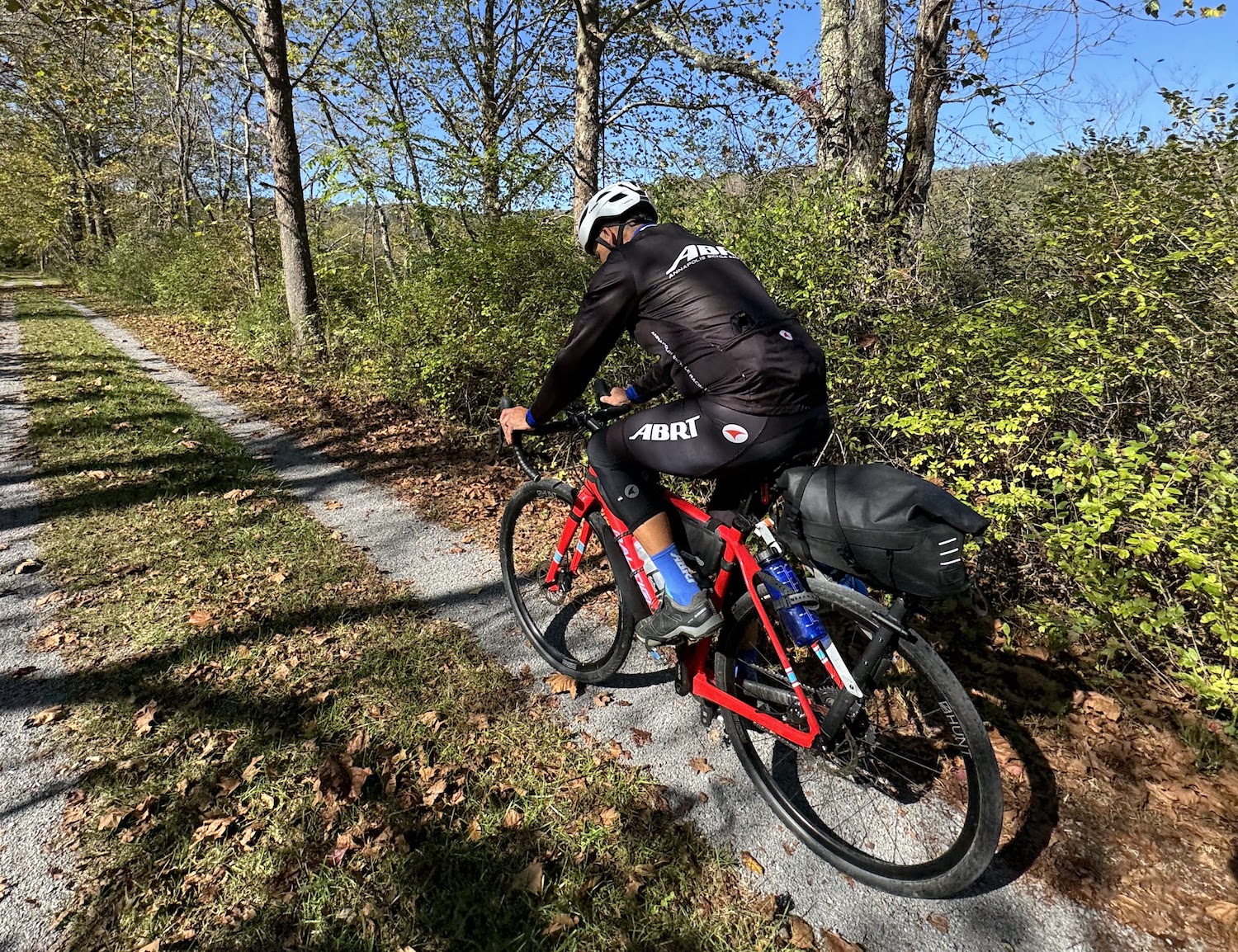
The next morning for Day 1, we saddled up and I drove to the trailhead and the others met me there. The ride from Morgantown to Clarksburg is nominally about 50 miles and is three discreet sections of trail: Mon River Trail (crushed limestone), a road transition, the Marion County Rail Trail (mostly paved!), another gnarly road transition (hilly with zero shoulder), and the Harrison County North Rail Trail (big chunky gravel). I did much of that Harrison County trail in 2018 and it was a muddy mess, so this chunky gravel was a great improvement. The trail sections were all really nice, quiet and varied. I did not find the on road sections problematic, but I have a pretty high tolerance for road riding and can traverse that stuff fairly quickly so it really doesn’t bother me; it might suck, but you just grunt it out. However, not really for the faint of heart if you are not comfortable with riding in a lot of traffic. Once in downtown Clarksburg, we had another eight or so miles to the big box hell just outside the city (the kind of development pattern off the I-79 highway that Strong Towns rails against). What added insult to injury is we had to detour a long way to get under I-79, then along a 4 lane stroad during rush hour where everyone in the local area was going to one of the typical junky chain restaurants. But, all in all, the varied surfaces and conditions made for an interesting 64 mile day.
Ride with GPS route: https://ridewithgps.com/routes/32050747
Strava track: https://www.strava.com/activities/12632102842

Day 2 brought another spectacular knee warmer and jacket morning. We unwound our path through the big box hell and back through Clarksburg and on the road to the eastern trailhead at Wolf Summit. For a variety of reasons, the trail doesn’t go into Clarksburg, no doubt due to right of way issues (private ownership in a place that does that takes their private property rights as religion and some active rail in the city). But on the way out, I kept an eye out for the future trail alignment and spotted it a few miles before the trailhead so we jumped on it to check it out. It was shall we say “unimproved” but it was fun to see it there.
At Wolf Summit, we got on the trail proper. I remembered it from 2018 more as a grassy track with some minor stone and all of the videos of the trail I have seen show it as more packed dirt that can be really muddy when wet, similar to the C&O Canal surface. But what we quickly found was like #57 gravel stone (3/8″ to 1″) over much of the 70+ miles, basically what they use for most vehicle based gravel roads, and in many places on the eastern section, the stone was still fairly loose like it was laid in the last year or two. What we were to learn is that it was resurfaced between 2020 and 2022 due to installation of a fiber optic cable. Now the comment by the Mon River Trail Conservancy director made sense. This surface is definitely more “rough” than the typical recreational rail trail rider is looking for and reading some of the recent trail link reviews reflect this. This condition prompted a long discussion among the three of us about the trail and economic development along it. Basically, until it has a surface that has a more broad based appeal, they are unlikely to have much traffic. That may be true as a necessary but not sufficient condition; until the trail is more logistically accessible, either via non-auto transportation or connectivity with the GAP trail it will always remain isolated and won’t have a huge effect on the abutting rural communities.
Parkersburg to Pittsburgh (P2P) Corridor– The 238-mile Parkersburg to Pittsburgh Rail-Trail is already 80 percent complete; just a few short gaps exist in West Virginia to unlock a contiguous 150-miles plus stretch of rail-trail from Parkersburg to the state’s border with Pennsylvania. These gaps could be closed, and the potential of the corridor realized, within the next decade. This would link the existing North Bend Rail-Trail, Harrison North Rail-Trail, West Fork River Trail, and Mon River Rail-Trail and the cities of Parkersburg, Clarksburg, Fairmont, and Morgantown, WV.
Mon River Trail Conservancy / Industrial Heartland Trails Coalition (IHTC)
Personally, I was really happy about this resurfacing as it’s basically the same stuff we ride in Loudoun County and while it was not wet for this trip, I am sure it’s much better now when wet. I reduced my tire pressure a bit which is always more comfortable and it was really nice to ride on.

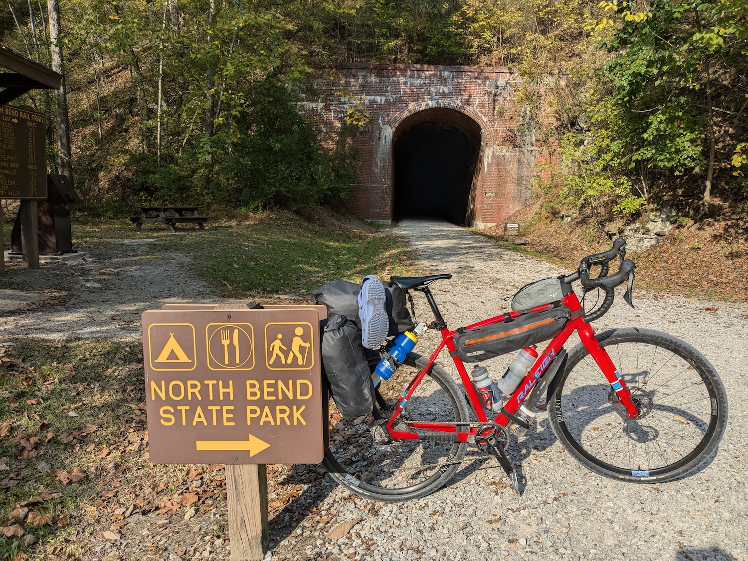
The trail is very remote with only a few towns of any substance and not much resupply so you have to make sure you have what you need with you. Perhaps the most notable thing of this trail are the 10 tunnels of varying length. The unique feature to me is that most of them have some curvature along their length, not something you see often on these kinds of tunnels. I didn’t have a light because I forgot it, and I ended up using my phone flashlight to get the bare minimum amount of light to not get disoriented. I tried a few times to ride without it and even though I could see the proverbial light at the end of the tunnel, not being able to see the walls or surface was very disorienting, making me feel like I would drop off the surface into the side ditches, so I had to stop and pull out my phone.

The towns along the trail are definitely from a bygone train era and once much of the extractive industry and passenger rail ended in the late 70s their raison d’être evaporated. West Union is probably the most intact town as it is the county seat of Doddridge County, has a fantastic piece of civic architecture, and still has a functionally intact and active 2 block downtown.

Salem also has some historic architecture and the former home of Senator Jennings Randolph.


Pensboro still has a depot and a few stores and some civic activity:


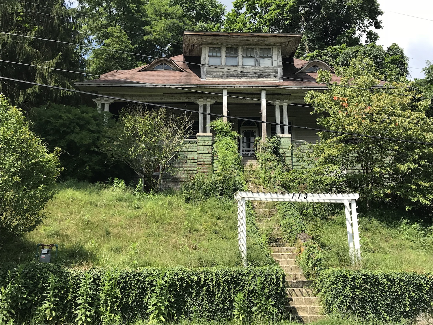
But many of the former rail towns are just in name only with a few dispersed residences along the trail. The section of US 50 from Clarksburg to Parkersburg runs parallel to the trail and is part of Corridor D of the Appalachian Development Highway System. I’m sure the construction of that highway system was a net positive economically, but it for sure obsoleted the train and the rail town economies. In a way it’s too bad because it has made the dispersed area economically unviable from an infrastructure standpoint, but that’s probably an article for the Strong Towns website!
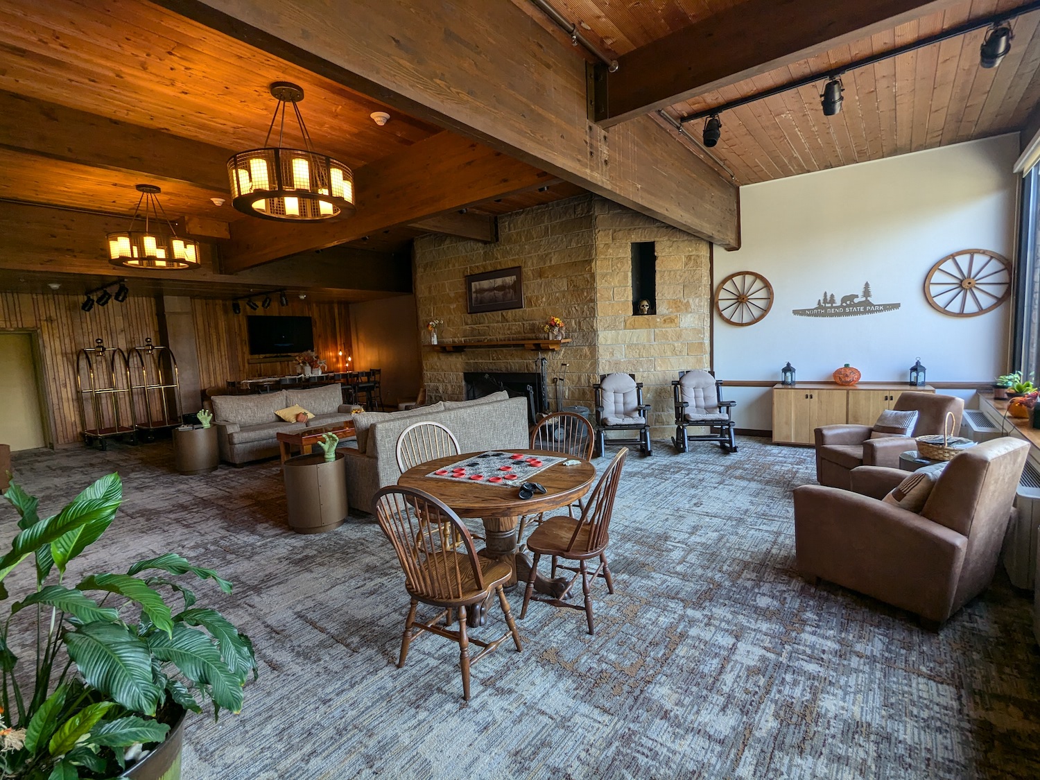
At mile 50 on the trail we took the spur into the second stop at North Bend State Park. This is another well loved park which was evident by the nice campsites and campers. We had a room at the Lodge which was really nice. The kicker, literally, was that it was near the park entrance which was up two very steep hills, but definitely worth it. They had a nice restaurant with good local IPAs and a buffet breakfast that made for a great one stop experience.

Ride With GPS route: https://ridewithgps.com/routes/32051000
Strava track (58 miles): https://www.strava.com/activities/12640041030
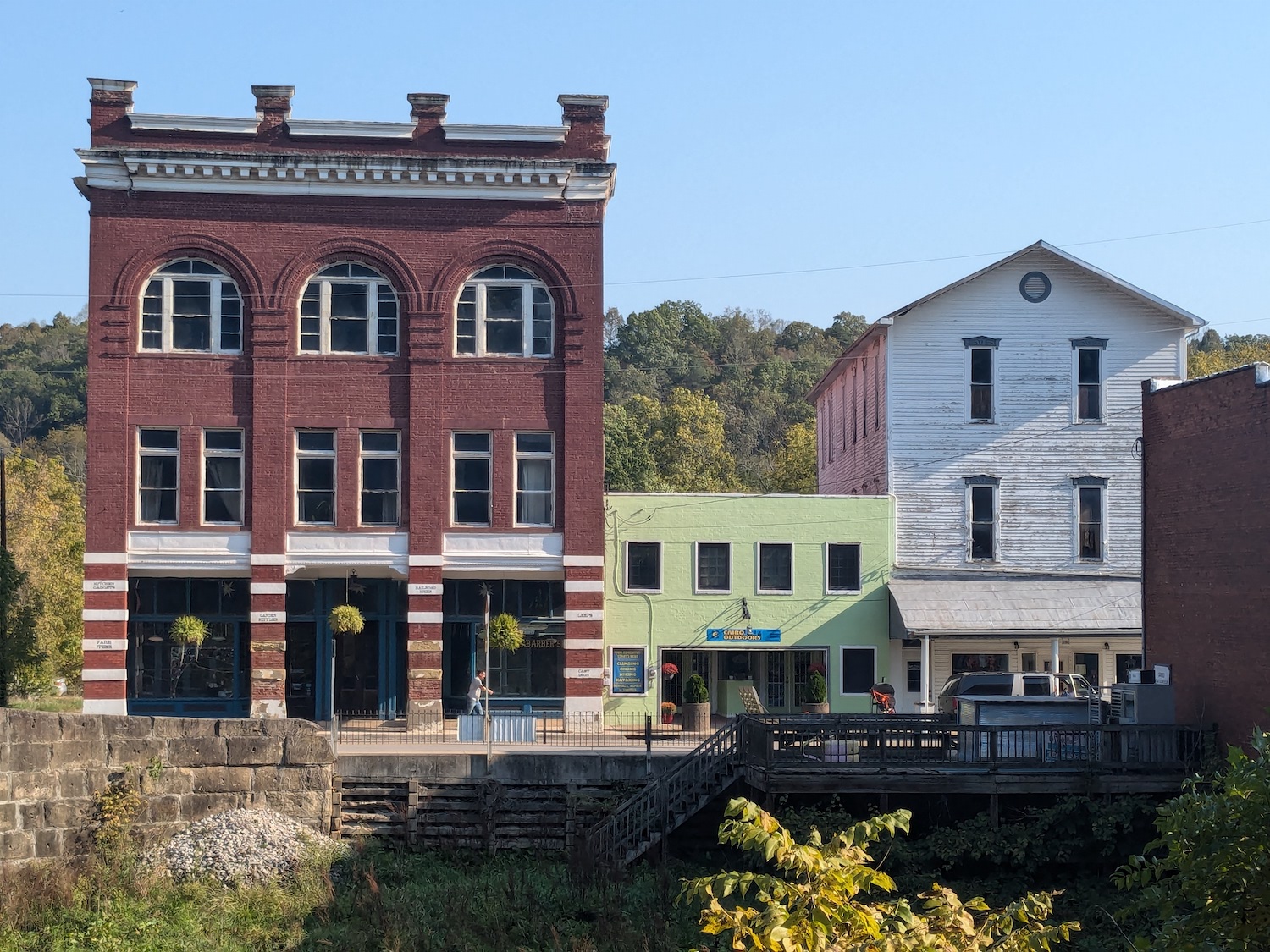
Day 3 was a short day of 27 miles. It was just as spectacular a day but with slightly warmer morning temps in the 60s and a strong SW wind that you could feel in more exposed places. But the short day was uneventful and the the only town of note was Cairo which has an old, rather unique Italianate bank building that is now home of the North Bend Rails To Trails Foundation. Every one of these towns had a bank as the center of commerce to handle the money in the local economy.


We finished up, changed and drove into Parkersburg to look around and have lunch. Much to our chagrin, NOTHING except Sheetz was open on Sunday, but at least they had beer. After the beer and a sandwich, we drove back to Morgantown to find the van unaccosted, rearranged bikes, gear and people and hit I-68 back home. I’m really pleased I had the opportunity to do this route. It was indeed “Wild and Wonderful”. It might be interesting to revisit it as a longer “ride from the house” trip some day. But until then, I’ll leave it with my BeReal post in Parkersburg.
Strava track (31 miles): https://www.strava.com/activities/12647871467
Full Photo Album: https://photos.app.goo.gl/RZGX5b3BYWmJW6KK6

