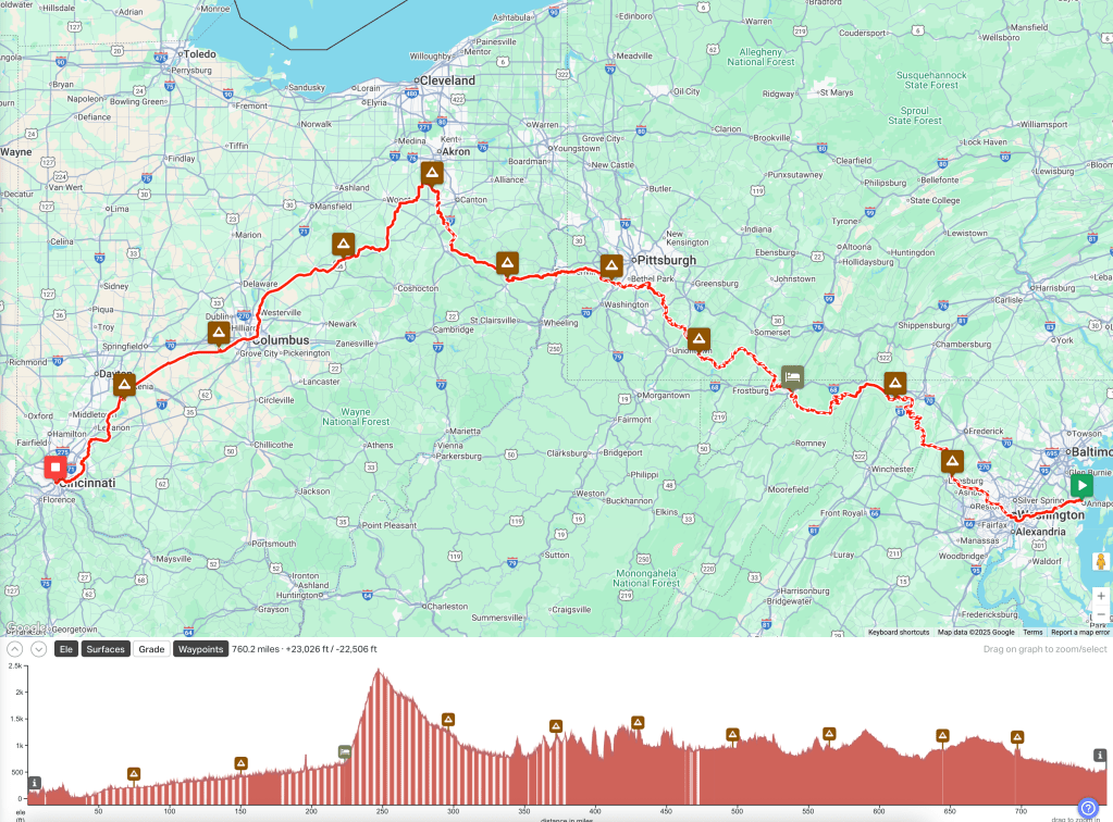
After dreaming about and planning a bikepacking route from Annapolis to Cleveland for over 10 years, I finally did it. 600 miles in 8 days.
You can go back and read those older posts (the first I wrote on this blog and are nowhere as long as the new ones!), but the motivation for this route came from my former ABRT teammates James Prickett (who did an epic C&O/GAP solo trip in 2007, my OG inspiration) and the Seiberts and Faurot/Lodrige crowd (who I did C&O trips with in 2012/2013). Since I’ve done the entire route to (actually from) Pittsburgh with Charles in 2018 and know what to expect on that part, the extension to Cleveland seemed like a relatively easy goal to tackle. In addition, Lisa and I were headed out to the Snipe US Masters Championships in Green Lake WI, so she could swing by and pick me up, greatly simplifying the end of the trip logistics.
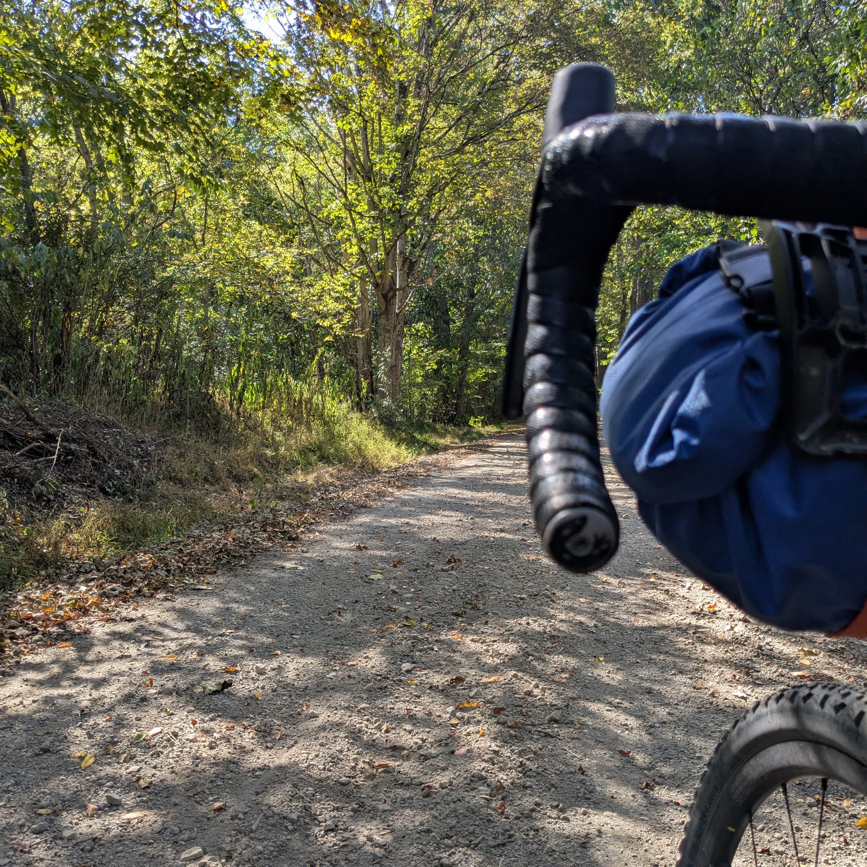
This trip originally started out as an eleven day trip from Annapolis to Cincinnati, incorporating most of the trip to Cleveland but instead of turning north when connecting to the Ohio& Erie Canal Towpath in northeast Ohio, I’d head south on the opposite track – it has the overlay branding of the “Ohio To Erie Trail (OTET)” – which is always highly recommended by bikepackers so I was interested in doing it. Obviously from the title, I didn’t do the entire route, but more on that later. I have a lot more bikepacking and camping experience ten years later so the major differences in the program were riding from Annapolis and virtually all camping instead of “credit card camping” (hotels). This added weight and miles, but really is my preferred mode now and opened up how I broke up the trip.
The route was more or less the same as originally planned, the standard ride to DC, C&O, GAP, Montour/Panhandle trails around Pittsburgh, on road in NE Ohio and the O&E Towpath to Cleveland. I did tweak things a bit with RWGPS routing to stay south of Pittsburgh and to find more off-road after crossing the Ohio River. Those changes made things a bit spicy in places (details for the hardcore’s below) but that was welcome after so much steady pedaling trail miles. Ultimately I broke the trip up into almost exactly 75 miles days with the available camping spots I could find. I have done a number of fully loaded bikepacking days this long but never 11 days consecutively, so this would be a stretch effort wise. But the forecast was idyllic with warm days and cool nights and no rain at all, so not much chance of weather making it harder. Plus it’s been such a dry fall, the C&O especially would not be goopy. There was a little rain on the first night but that’s it. The rest were warm days and cool (cold!) nights, quintessential early fall.
I really enjoyed experiencing the hiker/biker campsites on the C&O as I’ve seen them forever, but never used one. They are very nice and the NPS really does maintain the portable toilets and there is non-potable water to use to clean up with. The Marriott in trailside in Cumberland is a really popular stop and being able have a post ride beer next door at Dig Deep Brewing, do laundry, go to a decent restaurant for dinner makes it worth the money and you get to chat with a bunch of other bike tourists. Ohiopyle State Park was an excellent full service campground (and cheap) and the next two were “primitive”, one on the Montour Trail and one in Harrison State Forest in Ohio. Like the C&O sites, they were primitive only in that they didn’t have water (I made sure to stop and fill my two 1-liter nalgenes as close as possible) and no electric. But both sites were really nice and convenient. I wish there would be more of these “sanctioned” trailside spots in other places. The last stop was a basically an RV Park (Clays Jellystone in Canal Fulton), which sucked for me as it wasn’t set up for a bike-in camper and was $100. I probably should have just wild camped on the O&E as I would have had the same experience and saved myself $100. The only saving grace was they had a bar, so I did get to have a beer that night. All of the camping overnights included my favorite Mountain House dehydrated backpacking meals (I brought 8) and my usual instant oatmeal/Bran Buds concoction along with the Starbucks instant coffee which is actually pretty good. I generally tried to stop and get a good sandwich for lunch and it was large enough, eat half and save the other half for post ride nibbling or even dinner.


As I mentioned, the trail riding was mostly a bit monotonous in a pleasant way and that’s a bit of a known issue with rail trails but the scenery and weather made up for it. That said, it was enjoyable riding nonetheless, especially when a little spice was stirred in with a GAP detour and I finally got to experience the new sections past the C&O/GAP that I had really been looking forward to seeing. You’ll have to read the “For the hardcores” section below for those details.
As I have learned from the trips I’ve done that are more than a few days, the first 3-5 days are the hardest as that’s when things start to hurt. But by the time you get to day 6 or 7, while things have “settled in”, you really need a “0 day” for general rest. That was the fatal flaw in my plan. By the time I got to the point where I would turn towards Cincinnati on day 8, I was really tired and did not feel like it would be fun to continue another four days at 75 miles a day without some rest. Furthermore, I bruised my nose (I fell asleep with my glasses on and must have bruised the bridge) and it hurt like hell and was giving me a headache; I wasn’t sure at the time if it was that or possibly a sinus infection from all the trail dust. But that was worrying me and I wasn’t sure if it would get worse, and that also contributed to my fatigue. So in the vein of plans are nothing, planning is everything, I shifted gears and headed north on day 8 to Cleveland opting to head there with a massive 90 mile push into downtown and out to Avon on the far west side to my friend Terry’s house. It was definitely the right thing to do for my body and was a great opportunity to hang with Terry for 3 days and get caught up until Lisa picked me up.
All of that said, it was a great trip and I really enjoyed seeing the parts that were west of the C&O/GAP that I hadn’t seen before. I did make a few changes to my set up (all food stuff in the handlebar bag, tent in one pannier, pad/sleeping bag in the other and all clothes in the trunk bag) so things were very segmented making it easy to manage and in general everything on the bike worked well. And of course the weather, wow, fantastic. Although I really do need a heavier sleeping bag because I was a bit cold a few nights. I have purchased one, but it has a little more bulk and I have not figured out how to accommodate it. One last thought, and it’s really a revelation or affirmation of thoughts I’ve had in the past: I really don’t have any interest in doing the cross country trip I thought about last year. Frankly it would be lonely and a bit boring as much of the country is another version of a looong rail trail (eg hundreds of miles of cornfields). I’d rather do one to three week trips of specific areas of interest with interesting riding and things to see and the time/distance I think will depend on whether I have companionship. As an extroverted introvert, this eight days alone was fine, but I did find myself yearning for some companionship both while riding and afterwords by the end of the trip.
You can browse the entire photo album if want here: https://photos.app.goo.gl/uG5X1RA4WsoSD6jz9
OK, that’s the gist of the trip and for the hardcore’s here are the daily details.
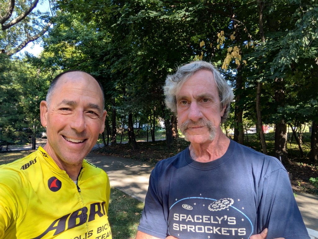
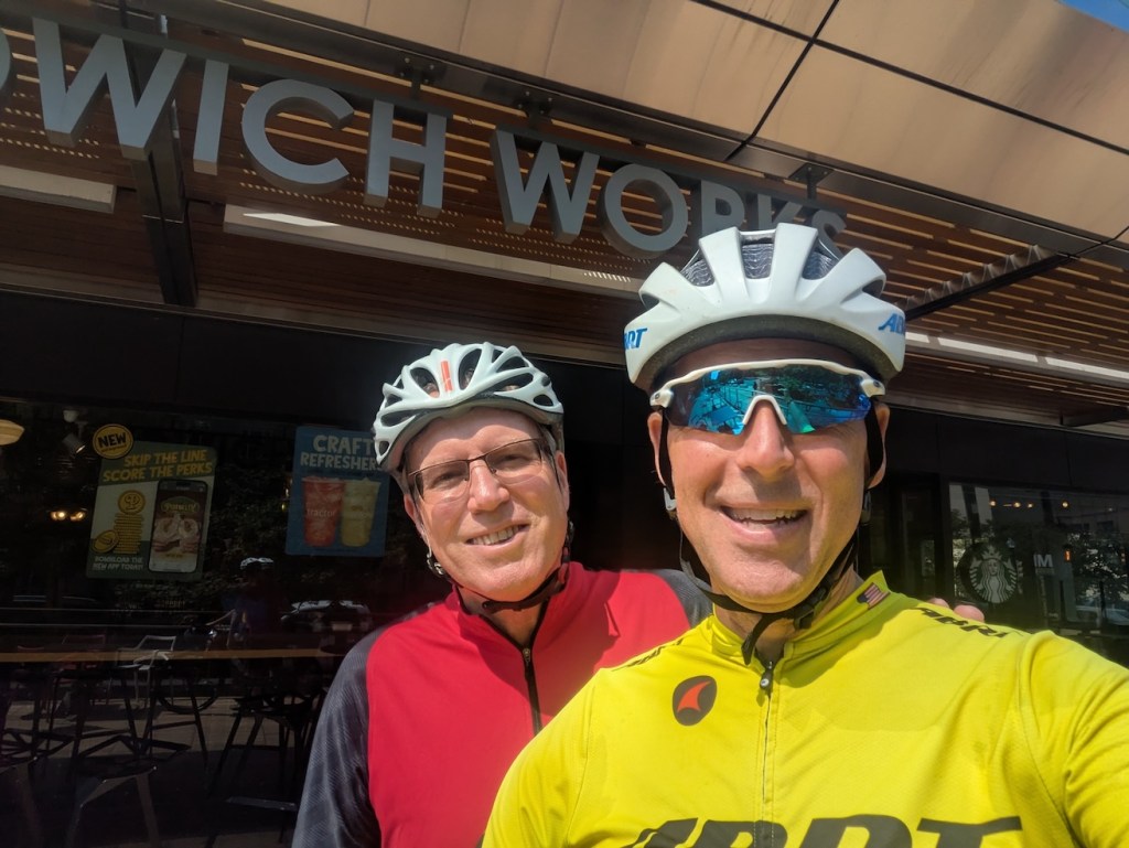
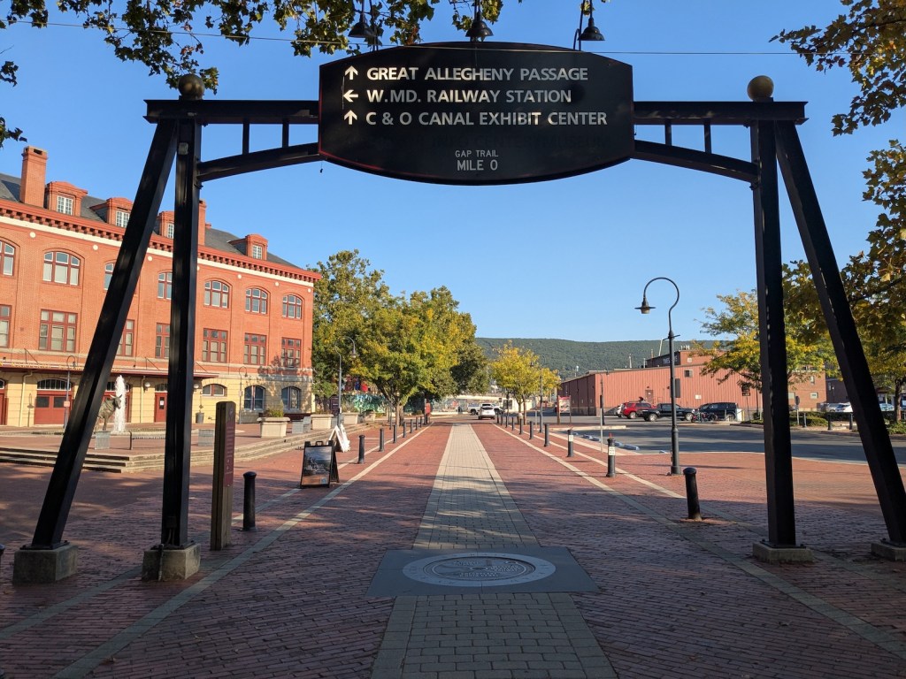
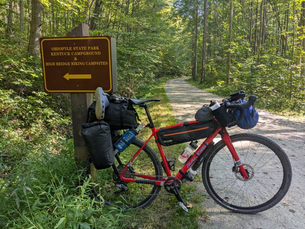
I set off Saturday September 5th, headed to DC and up the C&O. This route to DC is one I’ve done many times to NASA. I met Steve Davison in DC and he accompanied me up the trail until a bit after Great Falls where he turned around so he could make it back to DC at a reasonable time. I camped two nights at the Turtle Run and North Mountain Hiker/Biker sites. I did have a fellow camper at North Mountain and it was interesting to get his story. Arriving in Cumberland at the end of day 3, I stayed at the usual Marriott thanks to Lisa’s hotel points and was able to shower, do laundry and most importantly have a beer at the Dig Deep Brewery next door which is highly recommended. I really like Cumberland and it’s a shame there is not more economic activity there. The next day and a half was the GAP and I stayed over night at Ohiopyle State Park which has nice facilities, typical of many state parks. The only unknown was whether there was a direct path from the trail to the campground. There was, just a stones throw north of the center of Ohiopyle, but it was a half mile hike-a-bike which was hard after 75 miles. In retrospect, I probably should have stopped and had a beer in Ohiopyle first, but was unsure of how to get to the campground and once I was up that hike-a-bike, there was no way I was going down until the next day.
I really don’t have much to say about the C&O/GAP portion as there is tremendous amounts of ink and bits spilled about that. The only notable thing is the resurfacing projects on the C&O have made it a much nicer experience. It’s dusty and could be icky wet, but the only section that would have been the traditional mud out was about a 20 mile section directly below the Paw Paw tunnel. The surface of the GAP has always been quite nice with crushed limestone and since it’s either up or down it drains well. While those trails are nice to ride on and the scenery is generally very pretty, the riding is quite monotonous, not bad, just lacking spice. I’m constantly getting out of the saddle in a higher gear just to use different muscles. At the moment, the GAP has a 6 mile detour (Rookwood to Markelton) that virtually everyone uses a shuttle service to get around. But after hearing the on road detour was “awful” by a friend I took it as a challenge and even detoured from the detour onto a nice gravel road. It was fine and definitely added some needed spice with a bunch of really punch hills and some hike-a-bike on the really steep gravel. I loved it but the typical GAP rider would have really been put off.
Day 1 Strava (Annapolis to Turtle Run): https://www.strava.com/activities/15721481211
Day 2 Strava (Turtle Run to North Mountain): https://www.strava.com/activities/15734847103
Day 3 Strava (North Mountain to Cumberland): https://www.strava.com/activities/15744413301
Day 4 Strava (Cumberland to Ohiopyle SP); https://www.strava.com/activities/15756689611


On day 5 I left the GAP for the Montour Trail about 15 miles south of McKeesport which is the recommended exit point because it makes getting over the Monongahela River easier but there is a bit of road riding to get to it and the extra distance on the GAP didn’t work well with the available stops and my 75 miles per day. So I opted for getting off earlier and crossing on PA 51 which was a bit sketch as it is essentially a highway, but it was quick and soon thereafter connected with the trail in Clairtin PA. This incidentally is the childhood home of a deceased colleague at NASA (Mike Wargo), so I had a moment of silence for him looking at the Clairtin Coke Plant (where his father worked).
The Montour Railroad was used to access the Montour coal mines south and west of Pittsburgh. The rail trail surface was both crushed limestone and paved in places and more or less goes through suburban areas outside the city. It was very pleasant and had both up and down sections which did break it up nicely. The Kurnick Hiker Biker campsite was really nice, 4 spots immediately trailside with a portable toilet and a potable (city) water source that I didn’t know about. It’s only to be used by walkers and bikers but did look like it got some use. It felt a little weird to be so close to the trail where locals are riding, walking and jogging, but was quiet and really convenient.
Day 5 Strava (Montour Trail): https://www.strava.com/activities/15768725386


It was a pretty standard rinse/repeat camping experience and in the morning, I had a bout 10 miles of the Montour Trail before connecting to the Panhandle Trail that took me directly west to West Virginia and into Ohio. I knew I was getting tired on day 6 because I was making stupid navigational mistakes (like going left when my Garmin said right!) when connecting to the Panhandle trail as they don’t actually cross at the same grade.
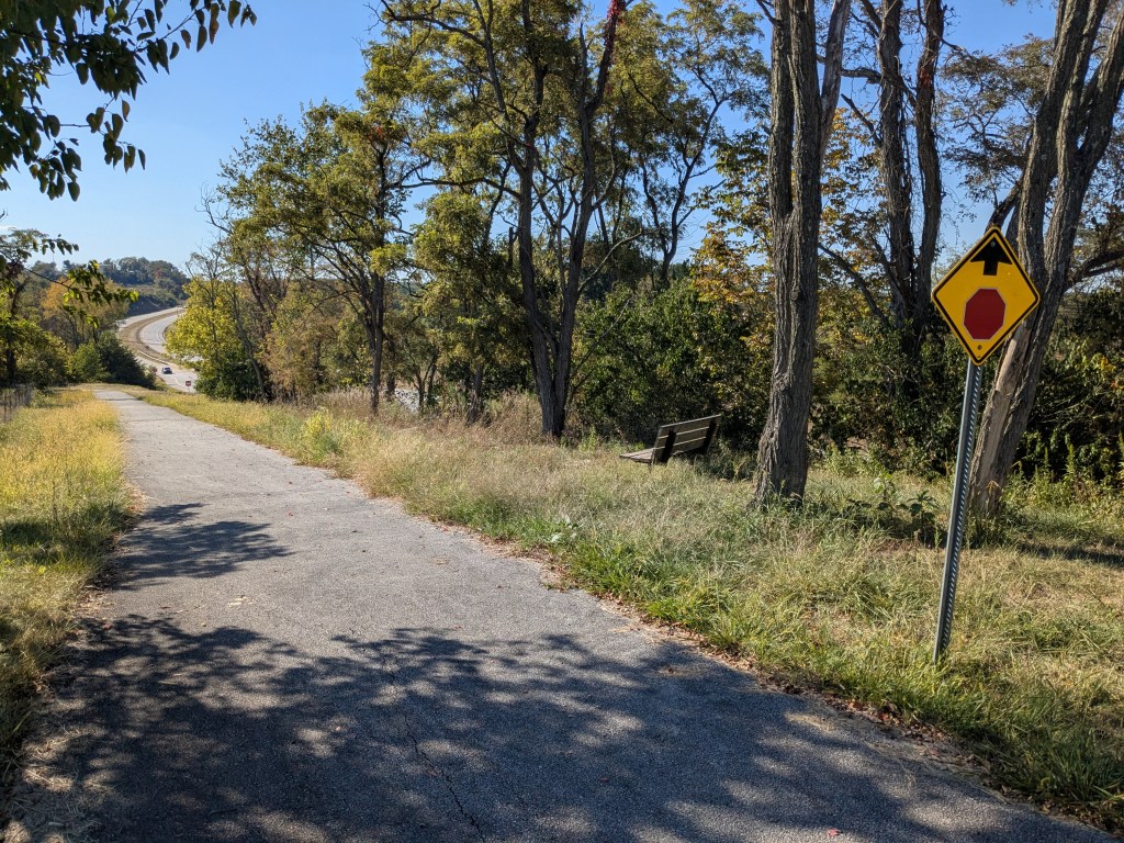
The Panhandle Trail heads directly west to into West Virginia and almost immediately, the terrain started to shift to something more akin to rolling farmland. Once in West Virginia, the trail runs along Harmon Creek and the terrain once again gets pretty lumpy and abruptly ends in Wierton where there are still active rail lines that run along the Ohio River requiring an earlier exit of the trail unless you want to turn around. I chose to exit at Colliers WV and head up and over the hill (7-10%) and down to the river near the base of the Market Street Bridge across the Ohio River into Steubenville. I had read the bridge was closed to all traffic and was worried about crossing at other sketch locations, so reached out to the Strong Towns Stuebenville local conversation to see if they had a suggestion. The leader, Jacob Hyman, said just cross anyway, no one will care. That was a great suggestion and after lifting my bike over the barrier, I walked across the bridge, a looong “cheese grater”. I connected with Jacob for lunch and to hear about the Strong Towns activities there. It was a pleasure to chat with him.


After lunch and a quick tour around the city, I continued along the route climbing out of the Ohio River basin. I did call an audible and changed the route to a state road after going a few hundred yards straight up on, of course, a street with the word “hill” in it, Coal Hill Rd which was a real ball buster. It added a little distance but was much easier. From there it was county and township roads that were mostly gravel, my preferred off the beaten track surface, but were very steep in places and did require some hike-a-bike with a fully loaded setup. But that’s a lot of the fun.

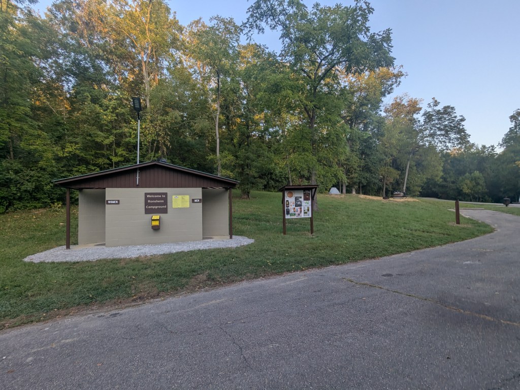
I eventually came to Harrison State Forest Ronsheim Campground and had no idea what to expect, but was very pleasantly surprised to find a short loop road with 8 free campsites and it was clear they had just renovated it. It was a great, secluded spot. On the way there, RWGPS routing lead me down a path that did not go through, a problem with not sanity checking the route that I had to backtrack out of. Other than getting some strange looks by a local, that’s part of the adventure. This was one of the shortest days but had the most climbing at about 4000′ so was still almost six hours on the bike.
Day 6 Strava (Kurnik Campground to Harrison State Forest): https://www.strava.com/activities/15780259820


The next day leaving the campground, I spent about 12 miles on the Conotton Creek Trail from Jewett to Bowerston, two small former rail towns. Given my experience on the hyper local gravel the day before, I decided to again alter the route to stay on OH 212 which was much more rolling and a bit to the north going past Atwood Lake. This was the original route I had planned way back when and since I was getting a little tired, the road riding was welcome and it was during the week so very little traffic. It’s mostly just northeast Ohio farm country but I was able to see Atwood Lake a place Lightnings and Thistles have traditionally raced on.


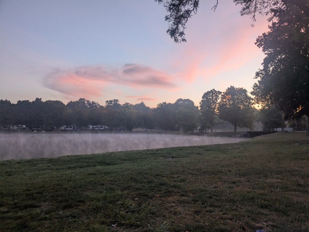
The road riding ended in Zoarville where I pickup op the Ohio & Erie Canal towpath, essentially the northern part of the Ohio to Erie Trail (OTET), the aforementioned branding overlay. My online scouting of this in prior years yielded little information about the condition, but it was very nice. A little single tracky in places but was still very pleasant especially since it was dry. I stopped at the Towpath Tavern in Bolivar for a great lunch hitting the Valade rule on the head today, a lunch stop at 2/3 of the day’s miles. To end the day I continued on the towpath all the way to Canal Fulton to the Jellystone RV Park. I’ve stayed in a lot of RV parks when bikepacking in the past, but this one is an all-time low, only because it’s really not set up for somebody like me riding in on a bike without a car full of camping crap. There was no picnic table and no place close to charge your phone, the shower water was sulfury well water, the porta potties near the tent site were nasty and to boot it cost me $100 just to pitch my tent. I hate to go down an urbanist rant here, but that park was the suburban version of RV Parks, very spread out and you really needed a golf cart to get around. Basically, a disney like version of suburbia rather than a disney like version of a city and I have a hard time understanding why anyone who lives in suburbia would go spend their time in, well, another version of suburbia, just with less space in a 5th wheel RV, a golf cart and a stinky campfire. It makes no sense to me. The only saving grace for me is they have a bar so I at least got a beer (of dubious quality to add insult to injury).
Day 7 Strava (Harrison State Forest to Canal Fulton): https://www.strava.com/activities/15790406125


This was the point in the ride where I had to make a decision. Do I turn “left” on the OTET and head to Cincinnati, another four days or do I turn “right” and head to Cleveland to my friend Terry’s and hang out for a couple days waiting for Lisa to pick me up. There were three factors that affected this decision: first, I was really tired having done seven back to back 70+ mile days, definitely a record for me. My “rule” is that I really need a “0 day” to rest once a week and continuing another four days would really have worn me out. Second, I had a really bad headache due to my nose hurting. Regardless of the cause, the headache was contributing to my fatigue. Third, if I went to Cleveland it was a much shorter trip for Lisa to pick me up on our way to the Snipe Masters Championships in Green Lake WI. Add these all together, and it was a pretty easy decision. While it bugged me a bit to “bail” on the original plan, the idea that it was the “Ride to Cleveland” I had thought about for so long wrapped the whole thing up with a bow. So with that, a “right” turn it was.
The last day was up the O&E towpath all the way to Cleveland. I was contemplating stopping that day on the east side of Cleveland to see a former NASA colleague and felt under some time pressure, so I didn’t make any stops for pictures through downtown Akron and through the locks north of the city although I called and rescheduled for Monday. One thing I learned is the canal has a high point in Akron and the locks are all numbered down from the high point on both sides, so there are two locks #1, two locks #2, etc. In Akron several of the Portage Lakes were used as feeder reservoirs for the canal, very similar to how Gatun Lake feeds the Panama Canal. I sailed Snipes in the past on Turkeyfoot Lake and I always wondered why they called it part of the “Portage Lakes”. Now that I know this canal history, it makes so much more sense. The grade change north of Akron is quite substantial and there are many locks so the trail is really fast down when heading north. This was really welcome because I was tired on this eighth day of riding. Once north of Akron I entered the Cuyahoga Valley National Park (which was super crowded on a beautiful Saturday). This is all familiar territory as I’ve ridding down there from Cleveland in recent years and had ridden there when I lived there 30+ years ago.
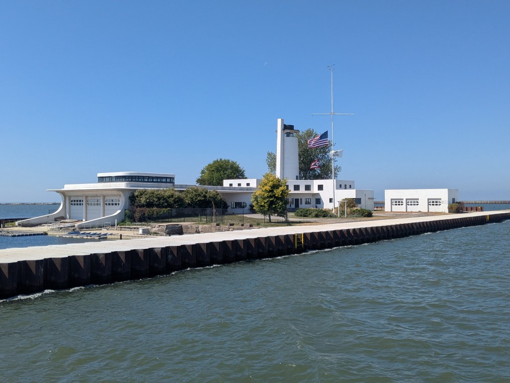
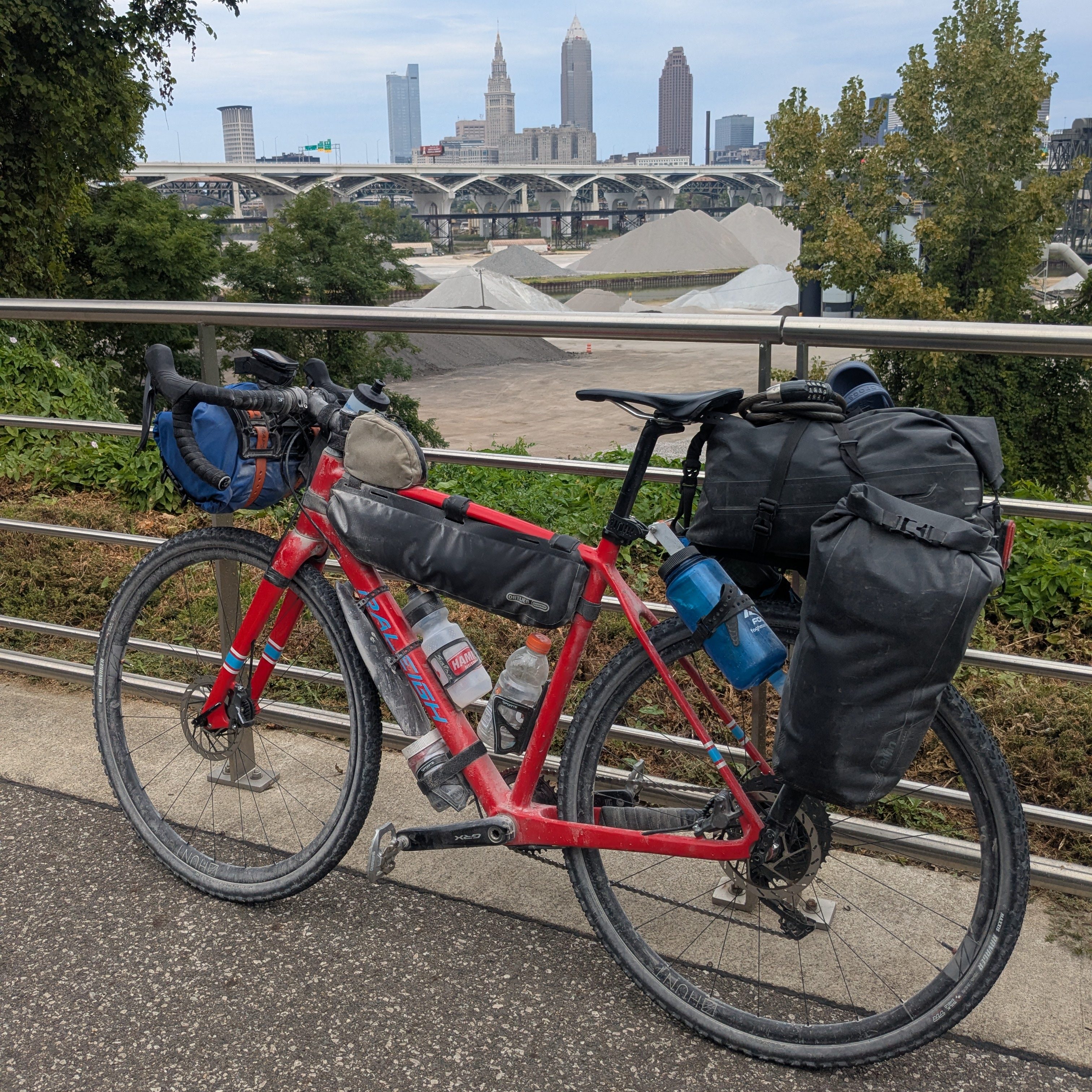
Once you get close to Cleveland the towpath becomes more of an urban bike trail that parallels the Cuyahoga River and has some spectacular views of the city. I recorded all of this visually in an album a few years ago because it’s such fantastic urban bike infrastructure. It continues through the Flats and into Wendy Park on Whiskey Island. The Cleveland Metroparks system has made this a nice park which only 10 years ago was pretty much a wasteland. It’s amazing the job they have done. In the Flats, I took a little tour around and stopped at the Margaritaville Restaurant on the east side (the site of the old Fagans) for a long lunch and to relax and charge my phone. From there it was another 25 miles out the west side bike path to Edgewater Park and out to Avon to my friend Terry’s house along what is signed as US Bike Route 30. It was a long day at 90 miles, but the last part from Edgewater Park to Avon was smooth, flat and had a slight tailwind, so it was very easy to roll along at 15-18 mph.
Day 8 Strava (Canal Fulton to Avon): https://www.strava.com/activities/15801840530
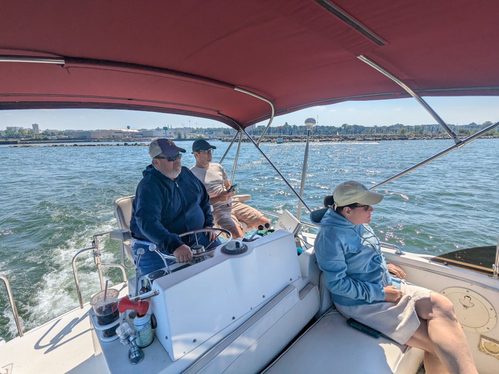
I hung out in Cleveland Sunday through Tuesday with Terry. Sunday we did a water-based tour up the Cuyahoga River and stopped at Merwin’s Wharf for cocktails. I am continually amazed at the development downtown. If I were a young guy, that is definitely where I would live! On Monday I did a nostalgia tour on the bike from downtown to CWRU (my alma matter) and out to visit my NASA colleague Paul Greenberg in Cleveland Heights for a few hours. On Tuesday I did an unloaded ride around Elyria/Lorain from Avon. It was very relaxing and a great opportunity to spend time with Terry and his family (we were each others’ best men). Lisa arrived with the van and boats Tuesday afternoon and we headed to Green Lake Wednesday morning.
Nostalgia Tour: https://www.strava.com/activities/15823888717
Elyria/Lorain Wanderabout: https://www.strava.com/activities/15834971102